5 Hidden Gem Hiking Trails in Whistler and Squamish
<p>The best hikes can sometimes be the ones on the road less travelled…<br>There’s an almost zen-like feeling that comes with wandering through the wilderness and being almost completely alone. It’s a rare opportunity to quietly take in all the natural beauty around you and truly relax.<br>Of course, the obvious way to achieve this glorious solitude is by trekking deep into the backcountry. And the Whistler and Squamish area have plenty of great trails for that. But if you’re not up for a multiple-day wilderness trek, you can still get that alone-in-the-woods feeling by going on a hike that most travellers haven’t heard of.<br>And that doesn’t mean you have to settle for a dull trail either. From an eerie ghost town to magnificent alpine meadows, both Squamish and Whistler are home to enticing trekking spots that simply aren’t on most people’s radars.<br>“One of the great advantages of our area is that there are truly so many options,” said Ryan Angus, of Whistler Alpine Guides.<br>So maybe you’ve already tackled a few of the best hiking trails in Whistler or Squamish, and now you’d like to find a route that’s off-the-beaten path. Or maybe, you’re just not a fan of crowds.<br>To help hunt down the top lesser-known trails, Leavetown got in touch with some local alpine experts, including the folks at <a href="https://www.whistler.com/" target="_blank" rel="noopener noreferrer">Tourism Whistler</a>, to compile this list of 5 little-known hiking trails in the Whistler and Squamish areas. Best of all, most of these trails can be done in a single day – so you can leave that backpack at home.<br> </p> <h3>1. TENQUILLE LAKE</h3> <blockquote class="instagram-media" style="background: #FFF; border: 0; border-radius: 3px; box-shadow: 0 0 1px 0 rgba(0,0,0,0.5),0 1px 10px 0 rgba(0,0,0,0.15); margin: 1px; max-width: 500px; padding: 0; width: calc(100% - 2px);" data-instgrm-captioned="" data-instgrm-version="7"> <div style="padding: 8px;"> <div style="background: #F8F8F8; line-height: 0; margin-top: 40px; padding: 50.0% 0; text-align: center; width: 100%;"> <div style="background: url(data:image/png; base64,ivborw0kggoaaaansuheugaaacwaaaascamaaaapwqozaaaabgdbtueaalgpc/xhbqaaaafzukdcak7ohokaaaamuexurczmzpf399fx1+bm5mzy9amaaadisurbvdjlvzxbesmgces5/p8/t9furvcrmu73jwlzosgsiizurcjo/ad+eqjjb4hv8bft+idpqocx1wjosbfhh2xssxeiyn3uli/6mnree07uiwjev8ueowds88ly97kqytlijkktuybbruayvh5wohixmpi5we58ek028czwyuqdlkpg1bkb4nnm+veanfhqn1k4+gpt6ugqcvu2h2ovuif/gwufyy8owepdyzsa3avcqpvovvzzz2vtnn2wu8qzvjddeto90gsy9mvlqtgysy231mxry6i2ggqjrty0l8fxcxfcbbhwrsyyaaaaaelftksuqmcc); display: block; height: 44px; margin: 0 auto -44px; position: relative; top: -22px; width: 44px;"> </div> </div> <p style="margin: 8px 0 0 0; padding: 0 4px;"><a style="color: #000; font-family: Arial,sans-serif; font-size: 14px; font-style: normal; font-weight: normal; line-height: 17px; text-decoration: none; word-wrap: break-word;" href="https://www.instagram.com/p/BRFgAk2lwyi/" target="_blank" rel="noopener">My very first overnight backpacking trip (without a Sherpa anyway) was to Tenquille Lake. This pic was from day 2, attempting to summit a nearby peak without following any trail. Got almost all the way up before chickening out. Methinks it's time for some mountaineering instruction so I can reach all the epic peaks I so seek. #summergoals</a></p> <p style="color: #c9c8cd; font-family: Arial,sans-serif; font-size: 14px; line-height: 17px; margin-bottom: 0; margin-top: 8px; overflow: hidden; padding: 8px 0 7px; text-align: center; text-overflow: ellipsis; white-space: nowrap;">A post shared by Hikes near Vancouver, BC (@hikesnearvancouver) on <time style="font-family: Arial,sans-serif; font-size: 14px; line-height: 17px;" datetime="2017-03-01T06:45:51+00:00">Feb 28, 2017 at 10:45pm PST</time></p> </div> </blockquote> <p><br>Dotted with stunning alpine views, this trek north of Pemberton is a top pick among staff at <a href="https://www.mountainskillsacademy.com/" target="_blank" rel="noopener noreferrer">Whistler Alpine Guides</a>, a local mountain school and guide service.<br>“One of the real attractions here is it’s a fairly low elevation alpine valley,” said Angus. “So it’s above the tree line, but it’s not incredibly high. That means it tends to produce alpine flowers quite early in the season.”<br>But despite the lush beauty found in this area, it’s not a super-popular trail among travellers. That’s in part because the road that brings you closest to the trailhead is often in rough shape and a four-wheel-drive vehicle might be needed for access. Once there, this hike can easily be done in a day.<br>The <a href="http://www.pembertonwildlifeassociation.com/" target="_blank" rel="noopener noreferrer">Pemberton Wilderness Association</a> also recently built a new cabin in the area, which contains a wood-burning stove and can sleep eight people.<br>“The new cabin is absolutely incredible, the lake is absolutely incredible and the alpine surroundings are absolutely incredible.”<br><strong>GETTING THERE:</strong><br>Drive up Highway 99 to Pemberton and then turn onto Pemberton Meadows Road in the northwest corner of town. Follow this road for about 20 minutes and then turn right onto Hurley Forestry Service Road and then finally to Branch 12. Taking this route to the nearby trailhead might require a four-wheel-drive vehicle.<br>There are other ways to access this trail as well, including starting the hike at the bottom of the Pemberton Valley. This adds about 7km to the trek.<br> </p> <h3>2. PARKHURST TRAIL</h3> <blockquote class="instagram-media" style="background: #FFF; border: 0; border-radius: 3px; box-shadow: 0 0 1px 0 rgba(0,0,0,0.5),0 1px 10px 0 rgba(0,0,0,0.15); margin: 1px; max-width: 500px; padding: 0; width: calc(100% - 2px);" data-instgrm-captioned="" data-instgrm-version="7"> <div style="padding: 8px;"> <div style="background: #F8F8F8; line-height: 0; margin-top: 40px; padding: 37.4537037037037% 0; text-align: center; width: 100%;"> <div style="background: url(data:image/png; base64,ivborw0kggoaaaansuheugaaacwaaaascamaaaapwqozaaaabgdbtueaalgpc/xhbqaaaafzukdcak7ohokaaaamuexurczmzpf399fx1+bm5mzy9amaaadisurbvdjlvzxbesmgces5/p8/t9furvcrmu73jwlzosgsiizurcjo/ad+eqjjb4hv8bft+idpqocx1wjosbfhh2xssxeiyn3uli/6mnree07uiwjev8ueowds88ly97kqytlijkktuybbruayvh5wohixmpi5we58ek028czwyuqdlkpg1bkb4nnm+veanfhqn1k4+gpt6ugqcvu2h2ovuif/gwufyy8owepdyzsa3avcqpvovvzzz2vtnn2wu8qzvjddeto90gsy9mvlqtgysy231mxry6i2ggqjrty0l8fxcxfcbbhwrsyyaaaaaelftksuqmcc); display: block; height: 44px; margin: 0 auto -44px; position: relative; top: -22px; width: 44px;"> </div> </div> <p style="margin: 8px 0 0 0; padding: 0 4px;"><a style="color: #000; font-family: Arial,sans-serif; font-size: 14px; font-style: normal; font-weight: normal; line-height: 17px; text-decoration: none; word-wrap: break-word;" href="https://www.instagram.com/p/BL4rh-WBreB/" target="_blank" rel="noopener">Abandoned backhoe near Whistler #abandoned #graffiti #lake #fall #explorebc #greenlake #parkhurstghosttown</a></p> <p style="color: #c9c8cd; font-family: Arial,sans-serif; font-size: 14px; line-height: 17px; margin-bottom: 0; margin-top: 8px; overflow: hidden; padding: 8px 0 7px; text-align: center; text-overflow: ellipsis; white-space: nowrap;">A post shared by Nikno (@niknonation) on <time style="font-family: Arial,sans-serif; font-size: 14px; line-height: 17px;" datetime="2016-10-23T00:39:26+00:00">Oct 22, 2016 at 5:39pm PDT</time></p> </div> </blockquote> <p><br>There’s no other hike quite like the Parkhurst Trail.<br>This small collection of paths guides you along the crumbling remains of an old logging town, named Parkhurst, that once thrived along the picturesque banks of Green Lake. The community began in 1926, but was abandoned 40 years later as the forestry industry slowed and the local mill shut down.<br>Today, most of the houses here have collapsed over the years – just one remains intact. But this area is littered with fascinating relics like rusted trucks and massive pieces of machinery. You might even find the shell of a once-white corvette that was left behind by squatters in the 1970s.<br>One of the most popular ways to get to the Parkhurst Ghost Town is to paddle across Green Lake. However, those who decide to hike here will be rewarded with a very atmospheric experience.<br>Hike up the ridge above Green Lake, on the way to the ghost town, and you’ll pass through a creepy section of forest. The trees here only have branches higher up and are eerily spaced far apart, making them seem almost lifeless. The forest sets the perfect mood before wandering through the ghost town.<br>But the terrain itself isn’t very scary – the Parkhurst Trail is an easy 5km route.<br><strong>GETTING THERE:</strong><br>You can hike to the <a href="http://whistlerhiatus.com/whistlerhikes/parkhurst-ghost-town.html" target="_blank" rel="noopener noreferrer">Parkhurst Ghost Town</a> along the Sea to Sky Trail starting either near Wedgemount or Lost Lake. The longest – but most beautiful – route begins directly from Lost Lake Park in Whistler Village. Expect to hike for about 2 hours to get there.<br> </p> <h3>3. BRANDYWINE MEADOWS</h3> <blockquote class="instagram-media" style="background: #FFF; border: 0; border-radius: 3px; box-shadow: 0 0 1px 0 rgba(0,0,0,0.5),0 1px 10px 0 rgba(0,0,0,0.15); margin: 1px; max-width: 500px; padding: 0; width: calc(100% - 2px);" data-instgrm-captioned="" data-instgrm-version="7"> <div style="padding: 8px;"> <div style="background: #F8F8F8; line-height: 0; margin-top: 40px; padding: 50.0% 0; text-align: center; width: 100%;"> <div style="background: url(data:image/png; base64,ivborw0kggoaaaansuheugaaacwaaaascamaaaapwqozaaaabgdbtueaalgpc/xhbqaaaafzukdcak7ohokaaaamuexurczmzpf399fx1+bm5mzy9amaaadisurbvdjlvzxbesmgces5/p8/t9furvcrmu73jwlzosgsiizurcjo/ad+eqjjb4hv8bft+idpqocx1wjosbfhh2xssxeiyn3uli/6mnree07uiwjev8ueowds88ly97kqytlijkktuybbruayvh5wohixmpi5we58ek028czwyuqdlkpg1bkb4nnm+veanfhqn1k4+gpt6ugqcvu2h2ovuif/gwufyy8owepdyzsa3avcqpvovvzzz2vtnn2wu8qzvjddeto90gsy9mvlqtgysy231mxry6i2ggqjrty0l8fxcxfcbbhwrsyyaaaaaelftksuqmcc); display: block; height: 44px; margin: 0 auto -44px; position: relative; top: -22px; width: 44px;"> </div> </div> <p style="margin: 8px 0 0 0; padding: 0 4px;"><a style="color: #000; font-family: Arial,sans-serif; font-size: 14px; font-style: normal; font-weight: normal; line-height: 17px; text-decoration: none; word-wrap: break-word;" href="https://www.instagram.com/p/BRHPxJTBi8j/" target="_blank" rel="noopener">Going from super hot and dry american deserts to exploring our own not so hot and pretty humid backyard! What a change of scenery! So amazing to still find places to explore right at our doorstep.</a></p> <p style="color: #c9c8cd; font-family: Arial,sans-serif; font-size: 14px; line-height: 17px; margin-bottom: 0; margin-top: 8px; overflow: hidden; padding: 8px 0 7px; text-align: center; text-overflow: ellipsis; white-space: nowrap;">A post shared by Catching the Fog (@catchingthefog) on <time style="font-family: Arial,sans-serif; font-size: 14px; line-height: 17px;" datetime="2017-03-01T23:02:25+00:00">Mar 1, 2017 at 3:02pm PST</time></p> </div> </blockquote> <p><br>Set in the spectacular Callaghan Valley, this short-yet-steep 6km trek takes you to achingly beautiful vistas of flower-filled meadows set against a mountain backdrop.<br>The route can be quite muddy at times. And with 550m of elevation gain over just 3km, the official Brandywine Meadows trail does require a certain fitness level. Expect about an 8 hour round trip hike.<br>However, there is a second access point at the end of a rugged former logging road that you can get to with a four-wheel-drive vehicle. This route allows you to avoid the super steep climb to the alpine scenery.<br>“It’s off-limits for the average tourist just because of the vehicle and road skills required to access that high elevation access point,” said Angus. “The low elevation access point offers a more suitable trek that the average person can access.”<br><strong>GETTING THERE:</strong><br>Both routes are difficult to find, so we suggest hikers get a reliable map before setting out. But here’s a quick overview of how to get there: about 14 kilometres south of Whistler Village on Highway 99, turn right when you see the Brandywine Valley sign. You’ll see another Brandywine sign shortly after that – turn left and drive down the road that passes to the left of the Waste Transfer Station.<br>You’ll soon pass through a large parking lot for snowmobiles. Take the gravel road at the far end of the parking lot and you’ll come to a fork: head straight, along an extremely rugged road, and you’ll arrive at the official trailhead in about 2km. Drive as far as you can and then walk the rest of the way.<br> </p> <h3>4. BREW LAKE TRAIL</h3> <blockquote class="instagram-media" style="background: #FFF; border: 0; border-radius: 3px; box-shadow: 0 0 1px 0 rgba(0,0,0,0.5),0 1px 10px 0 rgba(0,0,0,0.15); margin: 1px; max-width: 500px; padding: 0; width: calc(100% - 2px);" data-instgrm-captioned="" data-instgrm-version="7"> <div style="padding: 8px;"> <div style="background: #F8F8F8; line-height: 0; margin-top: 40px; padding: 33.75% 0; text-align: center; width: 100%;"> <div style="background: url(data:image/png; base64,ivborw0kggoaaaansuheugaaacwaaaascamaaaapwqozaaaabgdbtueaalgpc/xhbqaaaafzukdcak7ohokaaaamuexurczmzpf399fx1+bm5mzy9amaaadisurbvdjlvzxbesmgces5/p8/t9furvcrmu73jwlzosgsiizurcjo/ad+eqjjb4hv8bft+idpqocx1wjosbfhh2xssxeiyn3uli/6mnree07uiwjev8ueowds88ly97kqytlijkktuybbruayvh5wohixmpi5we58ek028czwyuqdlkpg1bkb4nnm+veanfhqn1k4+gpt6ugqcvu2h2ovuif/gwufyy8owepdyzsa3avcqpvovvzzz2vtnn2wu8qzvjddeto90gsy9mvlqtgysy231mxry6i2ggqjrty0l8fxcxfcbbhwrsyyaaaaaelftksuqmcc); display: block; height: 44px; margin: 0 auto -44px; position: relative; top: -22px; width: 44px;"> </div> </div> <p style="margin: 8px 0 0 0; padding: 0 4px;"><a style="color: #000; font-family: Arial,sans-serif; font-size: 14px; font-style: normal; font-weight: normal; line-height: 17px; text-decoration: none; word-wrap: break-word;" href="https://www.instagram.com/p/7s4CNStxDE/" target="_blank" rel="noopener">Shot of Brew Lake. Hiking into this wasteland of erratics reveals and this amazing paradise. Since its seldom hiked you will almost always get the lake to yourself.</a></p> <p style="color: #c9c8cd; font-family: Arial,sans-serif; font-size: 14px; line-height: 17px; margin-bottom: 0; margin-top: 8px; overflow: hidden; padding: 8px 0 7px; text-align: center; text-overflow: ellipsis; white-space: nowrap;">A post shared by Cathleen (@mymountainlife) on <time style="font-family: Arial,sans-serif; font-size: 14px; line-height: 17px;" datetime="2015-09-16T18:15:30+00:00">Sep 16, 2015 at 11:15am PDT</time></p> </div> </blockquote> <p><br>This amazing trek in Squamish’s Callaghan Valley is for very experienced trekkers only – please do not attempt without proper research and equipment!<br>If you love hiking, you’ll love Whistler and Squamish. From the spellbinding scenery around Garibaldi Lake to the stunning peaks of Stawamus Chief, this region is well-known for its amazing trekking. And if you explore the most popular trails in the summer, you’re bound to meet up with plenty of like-minded hikers out enjoying the mountain air. While all those classic Whistler hikes are great, sometimes it’s nice to explore a path that doesn’t see so much traffic.<br>Remote, serene and virtually unknown to travellers (and many locals), the Brew Lake Trail offers the ultimate in alpine isolation. If you venture here, chances are you won’t see another soul during the entire trip.<br>Brew Lake itself is enticingly clear yet shallow. One side of the shore is lined by lush trees and sheer cliffs; on the other side rests piles of jagged boulders. Although it doesn’t offer the same epic beauty as more popular haunts like Wedgemount or Garibaldi Lake, Brew Lake is mesmerizing on a much smaller scale.<br>The trail to get here is a very steep 5km trek that’ll likely take you 2-4 hours one way. This route leads you over fields of boulders – some of them the size of buildings – as you navigate the rugged terrain. If you attempt this one, make sure you’re prepared.<br><strong>GETTING THERE:</strong><br>Like many of the best hidden hikes, finding the trailhead isn’t easy. Plus, active logging in the area can sometimes change the access points. So before you head out, make sure you’ve done your homework and know where you’re going.<br>Here’s a quick overview of one way to get to the trailhead: From Squamish, drive north on the Sea to Sky Highway. Turn left onto Brew Creek Road after 42km (it’s just past Brandywine Falls Provincial Park). You’ll then need to turn onto a logging road on your left that will lead to the trailhead. Park at the bridge if you’re not in a four-wheel-drive and start walking. The trailhead is located about a kilometre from the bridge, however, finding it is tricky because it’s not clearly marked.<br> </p> <h3>5. ANCIENT CEDARS TRAIL</h3> <blockquote class="instagram-media" style="background: #FFF; border: 0; border-radius: 3px; box-shadow: 0 0 1px 0 rgba(0,0,0,0.5),0 1px 10px 0 rgba(0,0,0,0.15); margin: 1px; max-width: 500px; padding: 0; width: calc(100% - 2px);" data-instgrm-captioned="" data-instgrm-version="7"> <div style="padding: 8px;"> <div style="background: #F8F8F8; line-height: 0; margin-top: 40px; padding: 62.4537037037037% 0; text-align: center; width: 100%;"> <div style="background: url(data:image/png; base64,ivborw0kggoaaaansuheugaaacwaaaascamaaaapwqozaaaabgdbtueaalgpc/xhbqaaaafzukdcak7ohokaaaamuexurczmzpf399fx1+bm5mzy9amaaadisurbvdjlvzxbesmgces5/p8/t9furvcrmu73jwlzosgsiizurcjo/ad+eqjjb4hv8bft+idpqocx1wjosbfhh2xssxeiyn3uli/6mnree07uiwjev8ueowds88ly97kqytlijkktuybbruayvh5wohixmpi5we58ek028czwyuqdlkpg1bkb4nnm+veanfhqn1k4+gpt6ugqcvu2h2ovuif/gwufyy8owepdyzsa3avcqpvovvzzz2vtnn2wu8qzvjddeto90gsy9mvlqtgysy231mxry6i2ggqjrty0l8fxcxfcbbhwrsyyaaaaaelftksuqmcc); display: block; height: 44px; margin: 0 auto -44px; position: relative; top: -22px; width: 44px;"> </div> </div> <p style="margin: 8px 0 0 0; padding: 0 4px;"><a style="color: #000; font-family: Arial,sans-serif; font-size: 14px; font-style: normal; font-weight: normal; line-height: 17px; text-decoration: none; word-wrap: break-word;" href="https://www.instagram.com/p/BMIBki8gtj9/" target="_blank" rel="noopener">bc exploring ?? #whistler #ancientcedarstrail #bc #exploring</a></p> <p style="color: #c9c8cd; font-family: Arial,sans-serif; font-size: 14px; line-height: 17px; margin-bottom: 0; margin-top: 8px; overflow: hidden; padding: 8px 0 7px; text-align: center; text-overflow: ellipsis; white-space: nowrap;">A post shared by Anne Sheridan (@annesheridan10) on <time style="font-family: Arial,sans-serif; font-size: 14px; line-height: 17px;" datetime="2016-10-28T23:40:38+00:00">Oct 28, 2016 at 4:40pm PDT</time></p> </div> </blockquote> <p><br>We think this is one of Whistler’s most under-rated easy hikes.<br>Wander this short, 5km loop and you’ll see some of the most massive groves of Old Growth forest in the Whistler area. Many of these trees are estimated to be more than 1,000 years old.<br>The best time to enjoy this calm stroll is in the fall, when the forest floor is layered in thick moss dotted with a kaleidoscope of different mushrooms. These features, mixed with the almost overwhelming stature of the ancient trees, create a surreal, fantasy-like ambience.<br>Trail improvements and upgrades to interpretive signs that were completed in 2013 make this family-friendly hike even more enjoyable.<br>There are also a few somewhat hidden spots you’ll want to watch for. For example, keep your eyes out for the waterfall just below the wooden footbridge. Plus, be sure to wander from the main path near the viewpoint post to take in stunning views of the Soo Valley.<br>Although the elevation gain is minimal, you should still allow yourself 2-3 hours for this gentle stomp.<br><strong>GETTING THERE:</strong><br>From Whistler, head north on the Sea to Sky Highway. As you pass Green Lake, turn left onto the 16 Mile Creek FSR (also known as Cougar Mountain Road) and follow it for about 4 kilometres. Watch for the wooden cabin on your left – the trail begins on the right just a few hundred metres from here.<br> </p> <h3>COME AND EXPLORE WHISTLER!</h3> <p>If you’re looking for more information about hiking in Whistler, check out our <a href="../../../../../magazine/whistler-hiking-guide/" target="_blank" rel="noopener noreferrer">Whistler Hiking Guide</a>. Additionally, need accommodation in the Whistler area? We’re here to help! Check out our list of excellent Whistler accommodations <a href="../../../../../accommodation/whistler/" target="_blank" rel="noopener noreferrer">here</a> or give our Destination Experts a call on 1.877.902.1616 – they’re available 7 days a week and can easily assist you with finding the perfect property.</p>
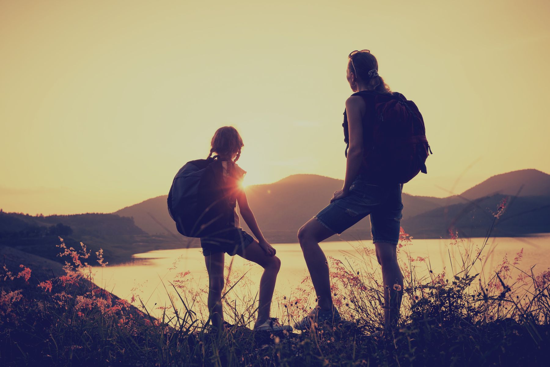
The best hikes can sometimes be the ones on the road less travelled…
There’s an almost zen-like feeling that comes with wandering through the wilderness and being almost completely alone. It’s a rare opportunity to quietly take in all the natural beauty around you and truly relax.
Of course, the obvious way to achieve this glorious solitude is by trekking deep into the backcountry. And the Whistler and Squamish area have plenty of great trails for that. But if you’re not up for a multiple-day wilderness trek, you can still get that alone-in-the-woods feeling by going on a hike that most travellers haven’t heard of.
And that doesn’t mean you have to settle for a dull trail either. From an eerie ghost town to magnificent alpine meadows, both Squamish and Whistler are home to enticing trekking spots that simply aren’t on most people’s radars.
“One of the great advantages of our area is that there are truly so many options,” said Ryan Angus, of Whistler Alpine Guides.
So maybe you’ve already tackled a few of the best hiking trails in Whistler or Squamish, and now you’d like to find a route that’s off-the-beaten path. Or maybe, you’re just not a fan of crowds.
To help hunt down the top lesser-known trails, Leavetown got in touch with some local alpine experts, including the folks at Tourism Whistler, to compile this list of 5 little-known hiking trails in the Whistler and Squamish areas. Best of all, most of these trails can be done in a single day – so you can leave that backpack at home.
1. TENQUILLE LAKE
Dotted with stunning alpine views, this trek north of Pemberton is a top pick among staff at Whistler Alpine Guides, a local mountain school and guide service.
“One of the real attractions here is it’s a fairly low elevation alpine valley,” said Angus. “So it’s above the tree line, but it’s not incredibly high. That means it tends to produce alpine flowers quite early in the season.”
But despite the lush beauty found in this area, it’s not a super-popular trail among travellers. That’s in part because the road that brings you closest to the trailhead is often in rough shape and a four-wheel-drive vehicle might be needed for access. Once there, this hike can easily be done in a day.
The Pemberton Wilderness Association also recently built a new cabin in the area, which contains a wood-burning stove and can sleep eight people.
“The new cabin is absolutely incredible, the lake is absolutely incredible and the alpine surroundings are absolutely incredible.”
GETTING THERE:
Drive up Highway 99 to Pemberton and then turn onto Pemberton Meadows Road in the northwest corner of town. Follow this road for about 20 minutes and then turn right onto Hurley Forestry Service Road and then finally to Branch 12. Taking this route to the nearby trailhead might require a four-wheel-drive vehicle.
There are other ways to access this trail as well, including starting the hike at the bottom of the Pemberton Valley. This adds about 7km to the trek.
2. PARKHURST TRAIL
There’s no other hike quite like the Parkhurst Trail.
This small collection of paths guides you along the crumbling remains of an old logging town, named Parkhurst, that once thrived along the picturesque banks of Green Lake. The community began in 1926, but was abandoned 40 years later as the forestry industry slowed and the local mill shut down.
Today, most of the houses here have collapsed over the years – just one remains intact. But this area is littered with fascinating relics like rusted trucks and massive pieces of machinery. You might even find the shell of a once-white corvette that was left behind by squatters in the 1970s.
One of the most popular ways to get to the Parkhurst Ghost Town is to paddle across Green Lake. However, those who decide to hike here will be rewarded with a very atmospheric experience.
Hike up the ridge above Green Lake, on the way to the ghost town, and you’ll pass through a creepy section of forest. The trees here only have branches higher up and are eerily spaced far apart, making them seem almost lifeless. The forest sets the perfect mood before wandering through the ghost town.
But the terrain itself isn’t very scary – the Parkhurst Trail is an easy 5km route.
GETTING THERE:
You can hike to the Parkhurst Ghost Town along the Sea to Sky Trail starting either near Wedgemount or Lost Lake. The longest – but most beautiful – route begins directly from Lost Lake Park in Whistler Village. Expect to hike for about 2 hours to get there.
3. BRANDYWINE MEADOWS
Set in the spectacular Callaghan Valley, this short-yet-steep 6km trek takes you to achingly beautiful vistas of flower-filled meadows set against a mountain backdrop.
The route can be quite muddy at times. And with 550m of elevation gain over just 3km, the official Brandywine Meadows trail does require a certain fitness level. Expect about an 8 hour round trip hike.
However, there is a second access point at the end of a rugged former logging road that you can get to with a four-wheel-drive vehicle. This route allows you to avoid the super steep climb to the alpine scenery.
“It’s off-limits for the average tourist just because of the vehicle and road skills required to access that high elevation access point,” said Angus. “The low elevation access point offers a more suitable trek that the average person can access.”
GETTING THERE:
Both routes are difficult to find, so we suggest hikers get a reliable map before setting out. But here’s a quick overview of how to get there: about 14 kilometres south of Whistler Village on Highway 99, turn right when you see the Brandywine Valley sign. You’ll see another Brandywine sign shortly after that – turn left and drive down the road that passes to the left of the Waste Transfer Station.
You’ll soon pass through a large parking lot for snowmobiles. Take the gravel road at the far end of the parking lot and you’ll come to a fork: head straight, along an extremely rugged road, and you’ll arrive at the official trailhead in about 2km. Drive as far as you can and then walk the rest of the way.
4. BREW LAKE TRAIL
This amazing trek in Squamish’s Callaghan Valley is for very experienced trekkers only – please do not attempt without proper research and equipment!
If you love hiking, you’ll love Whistler and Squamish. From the spellbinding scenery around Garibaldi Lake to the stunning peaks of Stawamus Chief, this region is well-known for its amazing trekking. And if you explore the most popular trails in the summer, you’re bound to meet up with plenty of like-minded hikers out enjoying the mountain air. While all those classic Whistler hikes are great, sometimes it’s nice to explore a path that doesn’t see so much traffic.
Remote, serene and virtually unknown to travellers (and many locals), the Brew Lake Trail offers the ultimate in alpine isolation. If you venture here, chances are you won’t see another soul during the entire trip.
Brew Lake itself is enticingly clear yet shallow. One side of the shore is lined by lush trees and sheer cliffs; on the other side rests piles of jagged boulders. Although it doesn’t offer the same epic beauty as more popular haunts like Wedgemount or Garibaldi Lake, Brew Lake is mesmerizing on a much smaller scale.
The trail to get here is a very steep 5km trek that’ll likely take you 2-4 hours one way. This route leads you over fields of boulders – some of them the size of buildings – as you navigate the rugged terrain. If you attempt this one, make sure you’re prepared.
GETTING THERE:
Like many of the best hidden hikes, finding the trailhead isn’t easy. Plus, active logging in the area can sometimes change the access points. So before you head out, make sure you’ve done your homework and know where you’re going.
Here’s a quick overview of one way to get to the trailhead: From Squamish, drive north on the Sea to Sky Highway. Turn left onto Brew Creek Road after 42km (it’s just past Brandywine Falls Provincial Park). You’ll then need to turn onto a logging road on your left that will lead to the trailhead. Park at the bridge if you’re not in a four-wheel-drive and start walking. The trailhead is located about a kilometre from the bridge, however, finding it is tricky because it’s not clearly marked.
5. ANCIENT CEDARS TRAIL
We think this is one of Whistler’s most under-rated easy hikes.
Wander this short, 5km loop and you’ll see some of the most massive groves of Old Growth forest in the Whistler area. Many of these trees are estimated to be more than 1,000 years old.
The best time to enjoy this calm stroll is in the fall, when the forest floor is layered in thick moss dotted with a kaleidoscope of different mushrooms. These features, mixed with the almost overwhelming stature of the ancient trees, create a surreal, fantasy-like ambience.
Trail improvements and upgrades to interpretive signs that were completed in 2013 make this family-friendly hike even more enjoyable.
There are also a few somewhat hidden spots you’ll want to watch for. For example, keep your eyes out for the waterfall just below the wooden footbridge. Plus, be sure to wander from the main path near the viewpoint post to take in stunning views of the Soo Valley.
Although the elevation gain is minimal, you should still allow yourself 2-3 hours for this gentle stomp.
GETTING THERE:
From Whistler, head north on the Sea to Sky Highway. As you pass Green Lake, turn left onto the 16 Mile Creek FSR (also known as Cougar Mountain Road) and follow it for about 4 kilometres. Watch for the wooden cabin on your left – the trail begins on the right just a few hundred metres from here.
COME AND EXPLORE WHISTLER!
If you’re looking for more information about hiking in Whistler, check out our Whistler Hiking Guide. Additionally, need accommodation in the Whistler area? We’re here to help! Check out our list of excellent Whistler accommodations here or give our Destination Experts a call on 1.877.902.1616 – they’re available 7 days a week and can easily assist you with finding the perfect property.
- 506 - 1168 Hamilton St Vancouver, British Columbia Canada, V6B 2S2
- +1 877 902 1616
- [email protected]
- Carrer Isaac Newton 2 Bloc A, d l'Edifici Naorte, Oficina 9 Parc Bit Palma de Mallorca, Islas Baleares Spain, 07121
- +34 871 550 584
- [email protected]
