The Best Hiking Trails to Explore in Panorama, BC
Panorama offers spectacular hiking for the beginner and expert hiker alike. Choose between easy family-friendly valley trails around the village or rugged hikes with high elevation and glacial-fed lakes atop Panorama Mountain.
Panorama is well-known for it’s family-friendly ski runs in the winter and it’s burly technical downhill biking trails in the summer. With such famed skiing and mountain biking, sometimes it gets forgotten that Panorama also offers spectacular hiking for the beginner and expert hiker alike. Choose between easy family-friendly valley trails around the village or rugged hikes with high elevation and glacial-fed lakes atop Panorama Mountain.
Just remember that if you do walk up the mountain, be aware that bikers have right of way on certain trails
Valley Trail
- Level: Easy
- Distance: 3.5km
- Length: 0.45 hours
- Elevation Gain: 0m
The Valley Trail is a family-friendly fully paved 3.5km loop that circumnavigates the village of Panorama. Short and sweet, you can complete this easy walk in less than an hour. To begin, head clockwise from the top of the Village Gondola to avoid the more strenuous uphill sections. For those seeking more of a workout, walk counter-clockwise and follow the directions below.
Trail Details
From the bottom of the Village Gondola, cross the Toby Creek via the suspension bridge and follow the path with the tennis courts to your left. Meander along the path closest to the creek until you reach a bridge that returns you on the side that you started on. You might catch people floating on an inflatable raft down the rushing whitewater of Toby Creek. Follow the trail along the creek before reaching the base of a series of switchbacks through dense forestry.
Head up the switchbacks, gain a little elevation and pass through the beautiful green fairways of Greywolf Golf Course where you can enjoy spectacular views of the surrounding mountains, especially Monument Peak. Keep your eyes peeled for bears or other wildlife on the green – but remember to keep your distance! The trail cuts through Greywolf Drive and makes its way to the base of the ski slopes of Panorama Mountain. Wander past the Sunbird chairlift, and walk underneath the Toby chairlift before winding around the Mile 1 Express chairlift to reach the Village Gondola.
Directions:
This trail begins right in the centre of Panorama at the Village Gondola.
Cox Creek Trail

Panorama Mountain Resort
- Level: Easy
- Distance: 3.5km
- Length: 1-1.25 hours
- Elevation Loss: 375m
Cox Creek trail is an easy downhill hike that offers incredible mountain vista views, numerous opportunities to some wildlife and finishes in the Upper Village – where you can reward yourself with a rest and a drink!
Trail Details
From the top of the Mile 1 Express chairlift, take a left and follow the start of the biking trails. Go past the beginning of the Crazytrain trail, take a right at the fork with Dog Town and ascend uphill. The trail winds through the forest on a narrow steep path that twists in between towering pine trees. At the next fork, turn left to stay on the Cox Creek Trail and follow the sound of water splashing on the rocks to make your way to Cox Creek. Cross the creek and follow it downstream briefly before the trail gains elevation again.
The trail pops out of the woods onto the Founders’ Ridge skiing area. Stop, take a breath, look west and enjoy the majestic view of Monument Peak in the background. If you’re lucky, you might see some wildlife grazing on the open grassy slopes. The trail carries on past the Ostrander ski run, onto the roadway, forks left and then leads you onto a number of switchbacks down the hillside. As you reach the end of the switchbacks, the trail takes a sharp right to pass a water reservoir and then forks to the left. As you approach to join the biking trail called Lookout, you must watch for bikers as they have right of way. Follow the gentle switchbacks all the way back to the village.
Directions:
Cox Creek Trail begins from the top of the Mile 1 Express chairlift.
Summit Trail
- Level: Moderate/Difficult
- Distance: 4.8km
- Length: 2-3 hours
- Elevation Gain: 930m
This trail takes hikers to the summit of Panorama Mountain Resort which offers stunning panoramic vistas of the Canadian Rockies and is a fantastic way to access other mountains in the area including: Mt. Goldie, Mt Taynton as well as a number of others peaks all connected by saddleback ridges. You could walk for days and feel like you’re on top of the world!
Trail Details
This trail can begin at the base of the Mile 1 Quad Chairlift or at the top. If you start at the bottom, you will add 1.6km distance, 369m elevation gain and can enjoy that extra feeling of satisfaction that you hiked Panorama Mountain from the very bottom. As you reach the top of the chairlift, take the uppermost fork that goes underneath the Champagne Express chairlift. After passing the top of the Sunbird, follow the wide service road all the way to the summit. For those who don’t have very good navigation skills, this is a great hike that you won’t get lost on.
The road weaves up the mountain to the top of the Champagne chairlift using the Rollercoaster, Millennium and World Cup Way ski runs. Once you reach the top of the Champagne chairlift for the final ascent, you can either go directly up the steep incline of the Top of the World ski run or head right and follow the ‘Easiest Way Down’ blue sign nailed to a tree. This trail follows a long but shallow part of the Getmedown biking trail and then the service road. The waving Canadian Flag at the summit is a warm welcome to the top.
Directions:
Summit Trail begins at the base of Panorama Mountain.
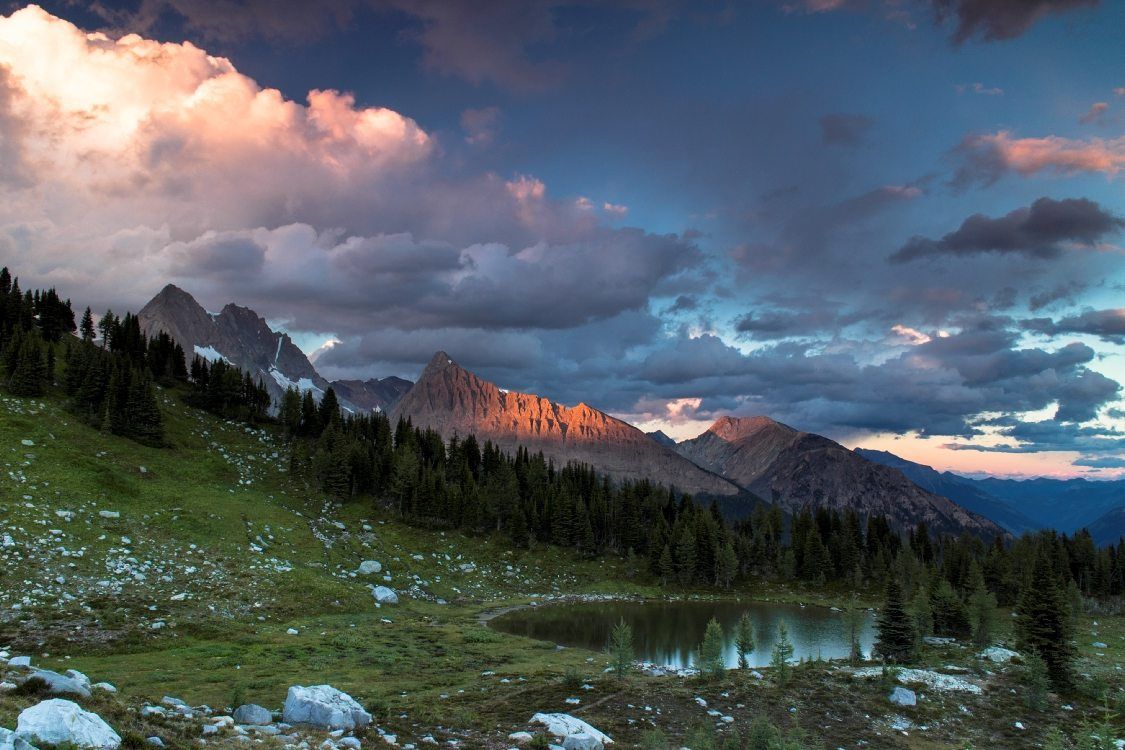
Jumbo Pass

Destination BC/Dave Heath
- Level: Moderate
- Distance: 12.2km roundtrip (or 6.1km to the Cabin)
- Length: 4-5 hours
- Elevation Gain: 600m (2300m – elevation at the top)
Jumbo Pass is a 6.1km moderate hike that begins in a logged area, weaves up the mountain through sub-alpine forest along easy switchbacks. You’ll pop out of the forest onto a beautiful pass which offers spectacular views of jagged peaks, colorful wildflowers and pristine alpine lakes.
Trail Details
The trail begins along the ski road on the left with the trailhead very clearly marked. After 1km the trail makes its way into a dense, cool forest and then opens out onto a small boulder field. You will quickly gain 300m elevation, reach a steep alpine creek with a square orange marker nailed to a tree that indicates a sharp right turn across the creek. From here, the cliffs of Bastille Mountain stand tall in the distance to your left. At 4km, the trees will become sparse and open out onto spectacular subalpine meadows where stunning wildflowers splash colour on the vast greenery ahead. This is the breathtaking Jumbo Pass.
At 5.2km, keep on the well-travelled trail (if it is unclear, keep to the right fork) and follow the signs to the hut just 0.9km away. For those after panoramic views, follow the inviting ridge line that leads to Mount Monica. The first peak is only a couple of minutes away and provides incredible views of Bastille Mountain, Starbird Glacier and Jumbo Mountain.
Directions:
From Panorama, turn left up Toby Creek Road which quickly turns to gravel. Continue along this gravel road for 18.8km, cross the bridge over Jumbo Creek and then turn right for Jumbo Creek Forest Service Road. Due to the high clearance needed and often muddy conditions, a 4×4 is recommended for the next part of the drive. With many logging roads branching off, follow the most obvious well-driven logging road. Once you are about 25km from Panorama, cross the bridge to the south side of Jumbo Creek. After 7km (14km up Jumbo Creek Forest Service Road), cross the final bridge. After another 2km, between 15km and 16km along Jumbo Creek FSR signs and just before a bridge, a marked skid road leads off to the left for the Jumbo Pass trail.
Lake of the Hanging Glacier

Karen Crow
- Level: Difficult
- Distance: 16km roundtrip (8km to the lake)
- Length: 5-6 hours
- Elevation Gain: 720m
This late summer season hike offers a rewarding end destination. Located in a cirque just below the Jumbo Glacier and Commander Glacier in the Purcell Mountains, the Lake of the Hanging Glacier is a stunning turquoise alpine lake surrounded by jagged snow-capped peaks. During this hike, you’ll often see mountain goats wandering around the area munching the vegetation.
Trail Details
With the trail being popular, it is easy to see where it begins just on the right of the Horsethief Forest Service Road. The trail ascends into a lush, dense forest through an old cut block.
Pass over Hellroaring Creek via the steel deck to re-enter the forest. At 3km, the trail leads downwards to a horse trail junction. Turn left and follow the footway that leads you to a metal bridge traversing Horsethief Creek. The trail winds through the forest then ascends via switchbacks alongside cascading waterfalls and a running creek that flows from the Lake of the Hanging Glacier.
At 6.4km, use the two-log bridge to cross over a small creek into an area that has been previously covby a rockslide. Make your way across the debris and follow the trail on the right side of the creek. As you climb up, you’ll pass through beautiful alpine meadows full of colourful wildflowers, a campsite and an outhouse before a wide plain of rocks marks the north end of the lake. The vivid blue of the Lake of the Hanging Glacier is surrounded by majestic mountains – The Commander Mountain to left, The Lieutenants in the middle and the Glacier Dome to the right – and the Jumbo Glacier.
Directions:
4WD is recommended to reach this trailhead. From Panorama, drive 18km towards Invermere on Toby Creek Road. Just before the Toby Bridge, turn left toward Wilmer. Drive through Wilmer to Westside Road and then pass over Horsethief and Forster creeks. After 10km of dirt road driving, you will reach a 4-way intersection where you turn left onto Horsethief Forest Service Road. At the 13km marker on the Horsethief FSR, stay left to continue following the main road. The trailhead to the Lake of the Hanging Glacier is just after the 49km marker (approximately 1.25 hours from Panorama).
Planning a Summer Getaway to Panorama?
We offer a number of great accommodations in Panorama, ranging from cozy condos to spacious townhomes. You can view our selection of Panorama accommodations here. Call our highly knowledgeable Destination Experts who can answer any questions you may have about the hiking trails in Panorama, or about the accommodations in the area. They’re available 7 days a week!
- 506 - 1168 Hamilton St Vancouver, British Columbia Canada, V6B 2S2
- +1 877 902 1616
- [email protected]
- Carrer Isaac Newton 2 Bloc A, d l'Edifici Naorte, Oficina 9 Parc Bit Palma de Mallorca, Islas Baleares Spain, 07121
- +34 871 550 584
- [email protected]
